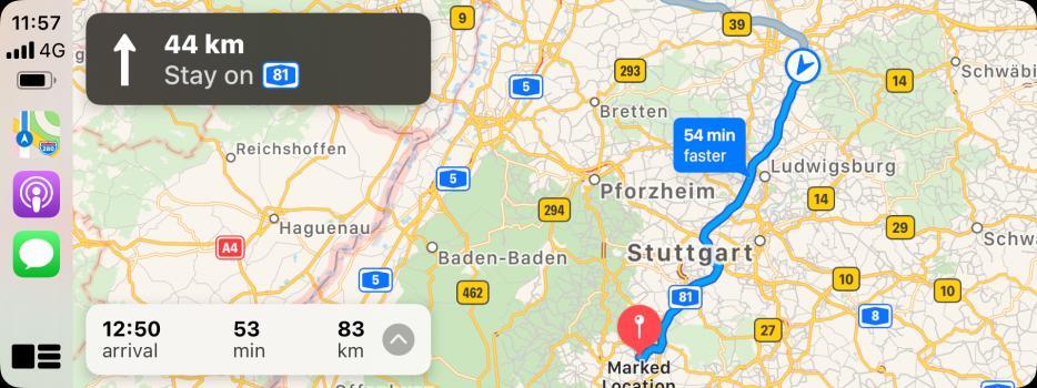
In iOS 15 you can now set the leaving or arrival time when you are getting driving directions https://www.macrumors.com/2021/06/07/apple-maps-leaving-arrival-times/.
Become a MacRumors Supporter for $50/year with no ads, ability to filter front page stories, and private forums.
The iOS14 Apple Maps Thread
- Thread starter MozMan68
- WikiPost WikiPost
- Start date
- Sort by reaction score
You are using an out of date browser. It may not display this or other websites correctly.
You should upgrade or use an alternative browser.
You should upgrade or use an alternative browser.
- Status
- The first post of this thread is a WikiPost and can be edited by anyone with the appropiate permissions. Your edits will be public.
Got it! Here’s a zoomed in view. Notice that little orange dot all the way on the left (the building to the left of Farrington St). It’s a POI marker. For a lot of those, you have to zoom in preeeeeeety far before you see what it actually is (of course you could also tap on it to open the info). Definitely brings up less clutter.
Also, these screenshots are from the “Explore” layer of the map (it’s new). If you want to see the traffic data, it now has it’s own separate layer.
View attachment 1788851
The buildings definitely have rounder edges in the new maps. And the obvious additions of the orange markings over commercial areas, as seen for the bowling alley and shopping center off to the left.
Very nice, thank you!
For San Francisco, how far out can you go before you lose the advanced detail?
Has anyone experimented with navigation yet?
View attachment 1788880
The buildings definitely have rounder edges in the new maps. And the obvious additions of the orange markings over commercial areas, as seen for the bowling alley and shopping center off to the left.
Very nice, thank you!
For San Francisco, how far out can you go before you lose the advanced detail?
Has anyone experimented with navigation yet?
Yeah…I really want to see the 3D view that comes up when exiting or changing lanes on a highway.
Now that one’s easier! Grew up in the Bay Area! Going north, the detail seems to stop at Navato.View attachment 1788880
The buildings definitely have rounder edges in the new maps. And the obvious additions of the orange markings over commercial areas, as seen for the bowling alley and shopping center off to the left.
Very nice, thank you!
For San Francisco, how far out can you go before you lose the advanced detail?
Has anyone experimented with navigation yet?
Going south…you lose it between San Jose and Morgan Hill.
Going east, Walnut Creek appears to be the furthest it goes. (So once again, the city I grew up in misses out…missed the cutoff for Look Around, too ?)
Now that one’s easier! Grew up in the Bay Area! Going north, the detail seems to stop at Navato.
Going south…you lose it between San Jose and Morgan Hill.
Going east, Walnut Creek appears to be the furthest it goes. (So once again, the city I grew up in misses out…missed the cutoff for Look Around, too ?)
Would you say that the "detailed" areas in San Francisco more or less cover the same ground as Look Around in that area? Makes me wonder if the detail for New York City will extend through all five Boroughs, much like Look Around does....
How abrupt is the change between detailed and less detailed? It looks pretty bad at transition points on Google Maps.
Yes it seems like we will have to wait until 2022 before the expansions begin to speed up. Four countries this year is actually the same amount as they did last year (if you count the public release of the United States).
“The expansions begin to speed up.” is an optimistic outlook, my friend! We have been talking about it for a while now. Along the lines of “Just let Apple finish the US rollout and the rest of the world will go at a much faster pace!” Unfortunately, this logical expectation seems to be shared by everyone, except Apple themselves, who are apparently super busy getting the colours and texture of their 3D models right. Forgive my sarcasm, but I actually like Apple Maps and am genuinely tired of waiting.
The simple way to put it is there IS quite a bit of overlap, but I don’t think I’d use it as a reliable guide for what to expect. It’s a safe bet for the core parts of the city, but once you start getting farther away, that’s where the overlap seems to fade a bit. For example, I mentioned Walnut Creek. It has the detail, but doesn’t have Look Around. Livermore, which is a 27ish mile drive southeast of Walnut Creek…does NOT have the detail, but DOES have Look Around.Would you say that the "detailed" areas in San Francisco more or less cover the same ground as Look Around in that area? Makes me wonder if the detail for New York City will extend through all five Boroughs, much like Look Around does....
How abrupt is the change between detailed and less detailed? It looks pretty bad at transition points on Google Maps.
I’ll get you a screenshot comparison of a transition point later today. Best way to describe it is I looked at the 101 out of San Jose and just followed it towards Morgan Hill. Detail, detail, detail…no detail. But what it didn’t do was show the detail with a cutoff point to “regular”. Once you I hit the cutoff point, the section of highway that had the detail transitioned to match the rest that didn’t. Basically at the cutoff point, you lose the detail even on the part you were looking at that had it. There wasn’t this line where on one side, it had detail and on the other, it didn’t. Horrible way to explain it, sorry ? I’ll remember to get those screenshots this afternoon!
The iOS 15 Maps thread has been created...and should be pinned to the top soon.
You can find it here... APPLE MAPS IOS 15 THREAD
You can find it here... APPLE MAPS IOS 15 THREAD
Great! I’ll post the screenshots for G1Ravage in there this afternoon!The iOS 15 Maps thread has been created...and should be pinned to the top soon.
You can find it here... APPLE MAPS IOS 15 THREAD
UPDATE: We're stickied...please post all new updates/pics in the new thread moving forward. Thanks!!
Last edited:
I’ll get a post going about CarPlay on the iOS 15 thread in a bit, but will address this real quick for you. I want to see this on a drive too, but this particular 3D feature isn’t available in my area yet, so I didn’t take any screenshots of it since there wouldn’t be anything to see.Yeah…I really want to see the 3D view that comes up when exiting or changing lanes on a highway.
Anyway, keep an eye on the iOS 15 thread. I’ll get going on that.
Yeah...Nothing on CarPlay until the Fall apparently. Will all have to be recorded while navigating on the phone.I’ll get a post going about CarPlay on the iOS 15 thread in a bit, but will address this real quick for you. I want to see this on a drive too, but this particular 3D feature isn’t available in my area yet, so I didn’t take any screenshots of it since there wouldn’t be anything to see.
Anyway, keep an eye on the iOS 15 thread. I’ll get going on that.
Encountered an accident report this morning. Unsure of its origins. Maps announced it like always. Only difference was that I had a new option on screen to “clear” it.
After getting home, I went back in Maps, and saw that a few more accident reports had popped up in the same vicinity. Leading me to believe they were possibly user-generated.

After getting home, I went back in Maps, and saw that a few more accident reports had popped up in the same vicinity. Leading me to believe they were possibly user-generated.
Nope...accidents have been on there (albeit with the new icon) forever...they are shared to Apple by traffic services.
You can actually zoom into major cities and typically see them on the map without even routing or being in that area.
You can actually zoom into major cities and typically see them on the map without even routing or being in that area.
Nope...accidents have been on there (albeit with the new icon) forever...they are shared to Apple by traffic services.
You can actually zoom into major cities and typically see them on the map without even routing or being in that area.
True, but with iOS 14.6, this was my first time encountering an accident during a route, and being given the option of "clearing" it on screen in CarPlay.
Also, when I initially drove through the area (I was on the service road adjacent to the main highway where the accident was), I was only seeing the one accident icon on screen. When I got home 15 minutes later and checked Apple Maps on my phone, there were now five accident icons in that area, some on the main highway, and some on the service road. I cleared off the extra ones, leaving only the correct one where the accident was.
Have you noticed that sometimes there are typically two accident icons? One at the actual accident site, and one near where the actual delays being caused by that accident begin?
Also, while driving on a highway the other night, I saw a tractor trailer parked in a somewhat hazardous spot on the shoulder. Using my car's spin dial controller, I went to submit a "hazard" report in Apple Maps, but I accidentally submitted an "accident" report instead. Not sure what to do, I activated Siri, and said "Cancel my previous accident report". And Siri responded, "Updating report".

Can't be certain that it was removed, but it sure sounded like it was....
I’ll only believe it once I see a police report or general “hazard”…I see accidents, construction, etc. on the map regularly….but not the way you did, so who knows?
I am impressed at how POIs in Look Around “attach” to their actual real life positions in a very 3D way. Ironically, as perfect as this looks, switching back to the regular top-down map shows the POIs jumbled and out of place. Had to send in some corrections to Apple.


What’s not as impressive is Google Maps for iOS, which just had another update, and still not only offers nothing special whatsoever to pull me away from Apple Maps, but seems to be devolving and getting worse as time goes on.

Highway shields are gone from the directions box in many cases. Remember those “sparkles” that plagued Apple Maps’ night mode shortly after iOS 14 debuted? Now Google Maps’ night mode has them. And I tried using Google Maps on CarPlay for navigation while listening to a baseball game on the MLB Audio app, and they kept cancelling each other out. Utter crap.
What’s not as impressive is Google Maps for iOS, which just had another update, and still not only offers nothing special whatsoever to pull me away from Apple Maps, but seems to be devolving and getting worse as time goes on.
Highway shields are gone from the directions box in many cases. Remember those “sparkles” that plagued Apple Maps’ night mode shortly after iOS 14 debuted? Now Google Maps’ night mode has them. And I tried using Google Maps on CarPlay for navigation while listening to a baseball game on the MLB Audio app, and they kept cancelling each other out. Utter crap.
The only thing Google Maps has that I want in Apple Maps is the incident/radar reporting feature that still isn't available in Canada. Otherwise, Apple Maps is perfectly fine for my day to day use.
For longer trips out of province, I still tend to default to Google Maps because Apple Maps has been less accurate/reliable in the past, but maybe that's changed now given that they appear to have driven/mapped all of Canada.
For longer trips out of province, I still tend to default to Google Maps because Apple Maps has been less accurate/reliable in the past, but maybe that's changed now given that they appear to have driven/mapped all of Canada.
The one thing that absolutely drives me crazy with Google Maps on iOS would be the experience of getting onto the highway as you have pictured. The transitions from road to ramp and ramp to highway are so abrupt causing the entire map to rotate way more than it should. I feel like I'm on my Garmin unit from 15 years ago.I am impressed at how POIs in Look Around “attach” to their actual real life positions in a very 3D way. Ironically, as perfect as this looks, switching back to the regular top-down map shows the POIs jumbled and out of place. Had to send in some corrections to Apple.
View attachment 1793975
View attachment 1793977
What’s not as impressive is Google Maps for iOS, which just had another update, and still not only offers nothing special whatsoever to pull me away from Apple Maps, but seems to be devolving and getting worse as time goes on.
View attachment 1793976
Highway shields are gone from the directions box in many cases. Remember those “sparkles” that plagued Apple Maps’ night mode shortly after iOS 14 debuted? Now Google Maps’ night mode has them. And I tried using Google Maps on CarPlay for navigation while listening to a baseball game on the MLB Audio app, and they kept cancelling each other out. Utter crap.
The one thing that absolutely drives me crazy with Google Maps on iOS would be the experience of getting onto the highway as you have pictured. The transitions from road to ramp and ramp to highway are so abrupt causing the entire map to rotate way more than it should. I feel like I'm on my Garmin unit from 15 years ago.
Yeah. I kinda wish Apple Maps would do something about that on local roads, where the local road suddenly becomes divided, or loses its divider. At least in general, Apple Maps is really smooth in its transitions. I like how when on highways, it focuses more on your general direction of travel, even if that means not centering the camera precisely behind your vehicle.
So at the moment I am out of town, and using Maps more frequently. I am on iOS 14.6, and have recently noticed “Editors’ Picks” on the main page of the app, pushing my Favorites down off the page. I checked with support, there is currently no way to remove/disable them. It doesn’t help that the Editor doesn’t seem to know in which city I actually am located, and it appears that their name is “Karen Wokenface.” Really don’t need their “suggestions.”
Last edited:
Where is this at?So at the moment I am out of town, and using Maps more frequently. I am on iOS 14.6, and have recently noticed “Editors’ Picks” on the main page of the app, pushing my Favorites down off the page. I checked with support, there is currently no way to remove/disable them. It doesn’t help that the Editor doesn’t seem to know in which city I actually am located, and it appears that their name is “Karen Wokenface.” Really don’t need their “suggestions.”
In the Maps app…or do you mean geographically?Where is this at?
Register on MacRumors! This sidebar will go away, and you'll see fewer ads.